With over three thousand miles of coastline, Maine’s shores range from wide sandy beaches, quiet bays and hidden inlets to marshlands and rocky outcroppings. The sights and sounds of these coastal environments are familiar to anyone who has ever spent time nearby: the exuberant hush of waves crashing, the call of gulls, and the sweet, briny smell of the shore.
For as long as humans have inhabited this land, the sea has provided for the wealth and health of its communities. In many ways, this place has become synonymous with the riches of its seas, and people around the world recognize Maine for its famous fisheries. However, as our environment changes and the Gulf of Maine continues to warm, researchers are beginning to take a closer look at our marine ecosystems and many people who make their livelihoods on the water are beginning to explore sustainable options for their future.
Maine’s most recognizable seaweeds are rockweed, officially known as Ascophyllum nodosum, or bladderwrack, Fucus vesiculosus. These are the seaweeds that you might see swaying gracefully in the water during high tide or fanning out across slippery, wet rocks when the water is out. With long fronds and mustard colored air bladders, they hold fast to rocks in the littoral zone; during storms, large quantities of rockweed break off their base and move where the current takes them. These float-away pieces can survive on their own in the water but frequently wash up on beaches, breakwaters, or jetties. When dried, their color darkens to a deep greenish-brown and the fronds become brittle and flaky. Both are nearly ubiquitous in Maine but there is no definitive data about how much of each exists along our coast.
For Dr. Jessica Muhlin, Professor of Marine Biology and Chair of Maine Maritime Academy’s Corning School of Ocean Studies, rockweed presents a kaleidoscope of opportunity. As a marine botanist, and specifically a phycologist (someone who studies algae), she has studied the plant closely. “I have always thought seaweeds were beautiful,” she explains. “But they are also really important to the overall health of the ecosystem and people often don’t give them much thought.”
Muhlin’s interest in rockweed is multidimensional, but her curiosity is broadly motivated by three main categories of inquiry: the ecological health of Maine’s intertidal environments, commercial potential, and the ability to measure change over time in the Gulf of Maine.
“Rockweed is what we call a foundational species,” says Muhlin. “If you think of [the ecosystem] as a building, rockweed is the foundation. It provides a buffer in terms of the physical environment, and the chemical environment provides opportunities for organisms to live on it, within it, and among it.”
Over the years, rockweed has become increasingly recognized for its commercial value and it is now harvested for many reasons. Today it is used in agriculture, cosmetics, food products, and medicine, where it is prized for its biochemical properties. Nutrient-dense and consumable, rockweed is also gradually gaining a foothold in the culinary world and specialty products are available to curious consumers around the globe.
The continued market growth of this resource will require management, and Muhlin recognizes the need to establish a baseline in order to monitor crop viability and the overall health of the species. “To make sure that we can sustainably harvest [rockweed], we need to know how much is available,” Muhlin continues. “Everything in the Gulf of Maine is changing so quickly so understanding how much is in the ecosystem, and how much might be available for economic and ecological sustainability is really, really important.”
“My motivation is to help sound resource management,” Muhlin says. “But there are practical business applications and a lot of possibilities.”
In 2018, Muhlin joined a group of researchers from the University of Maine and the Schoodic Institute on a project designed to survey rockweed habitats throughout the state and to collect data on the biomass, plant coverage, environmental conditions, and animal life present there. The project relied on meticulous field work and deep collaboration among project partners, and was funded by Maine Sea Grant, a federal-state partnership based at the University of Maine, sponsored by NOAA.
Buoyed by the success of that project, Muhlin continued the work to expand that initial survey and evolve the data collection process. While the on-the-ground surveying provided excellent information, it was time-intensive and inefficient. So, Muhlin and her team turned their eyes to the sky.
For decades, environmental resource managers have been exploring ways in which evolving technologies can positively impact the efficacy and precision of their work. Forest managers have become increasingly reliant on drones to survey canopy cover health and monitor soil conditions. With specialized cameras and long-range capabilities, they have fine-tuned the ability to survey large swaths of land from above and compile data sets on a scale that would previously have been unimaginable.
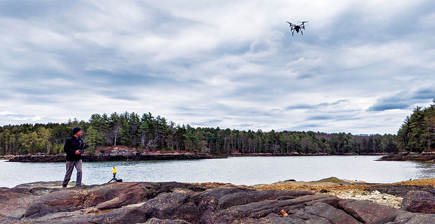
In 2020, Muhlin teamed up with Schoodic Institute Marine Ecology Director Hannah Webber, pilot Stefan Claesson, principal scientist of Nearview, LLC, and partners from Bigelow Laboratory for Ocean Sciences and the University of Maine to test a radical new technique for measuring seaweed growth along Maine’s shores: utilizing high-resolution imagery of Maine’s coast taken by an “Unoccupied Aerial System” (UAS). In other words, Muhlin and Webber are testing the viability of using drone imagery, taken from roughly 400 feet above the shoreline, to gather information about the health and density of the biomass below.

Stefan Claesson flies a drone equipped with a multispectral camera as part of Muhlin’s research on rockweed.
Photo Courtesy of Catherine Mitchell
“The conditions we need in the field are pretty specific,” Muhlin notes. “First, we need a low tide. Then, for doing the aerial work, we also need calm weather, clear skies, and a solar noon. Really, it’s glorious work because you are usually out on very beautiful days!”
When the conditions align, Muhlin and her team arrive at a field site as early in the day as possible. In addition to Webber and Claesson, there’s a ground crew of six to eight members who support shoreside data collection. Once the drone is in the air, Claesson takes a series of images, tagging each with GPS so that the team can track the precise location of each shot and cross reference it with analog data collected throughout the day.
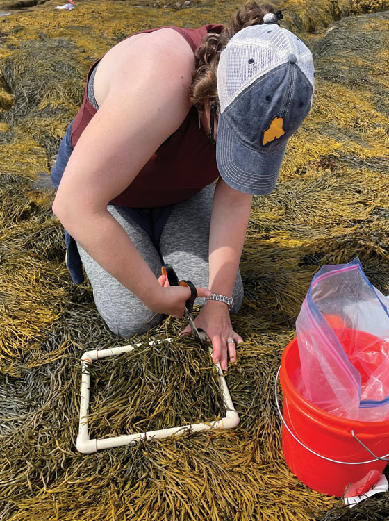
On the intertidal plane below, the ground crew places small square frames made of plastic piping in a grid formation on gnarled masses of seaweed. Using this transect method, each member of the team moves methodically across the mud and rocks. Carefully, they collect information about the type of seaweeds present in the frame, the depth and density of vegetation, and observations about the overall organic health of each quadrant. The work is slow and deliberate.
The drone on the other hand, moves quickly, usually completing two thirty-minute flights first thing in the morning. The drone is equipped with a spectrometer that provides researchers the spectral signature or a reflectance number of the biomatter that spreads out beneath clear skies. As a result, the images collected by the UAS are “multispectral,” meaning that they capture a spectrum of colors that are not visible to the human eye. This unprecedented degree of precision helps researchers determine the exact quantities of each seaweed in different areas.
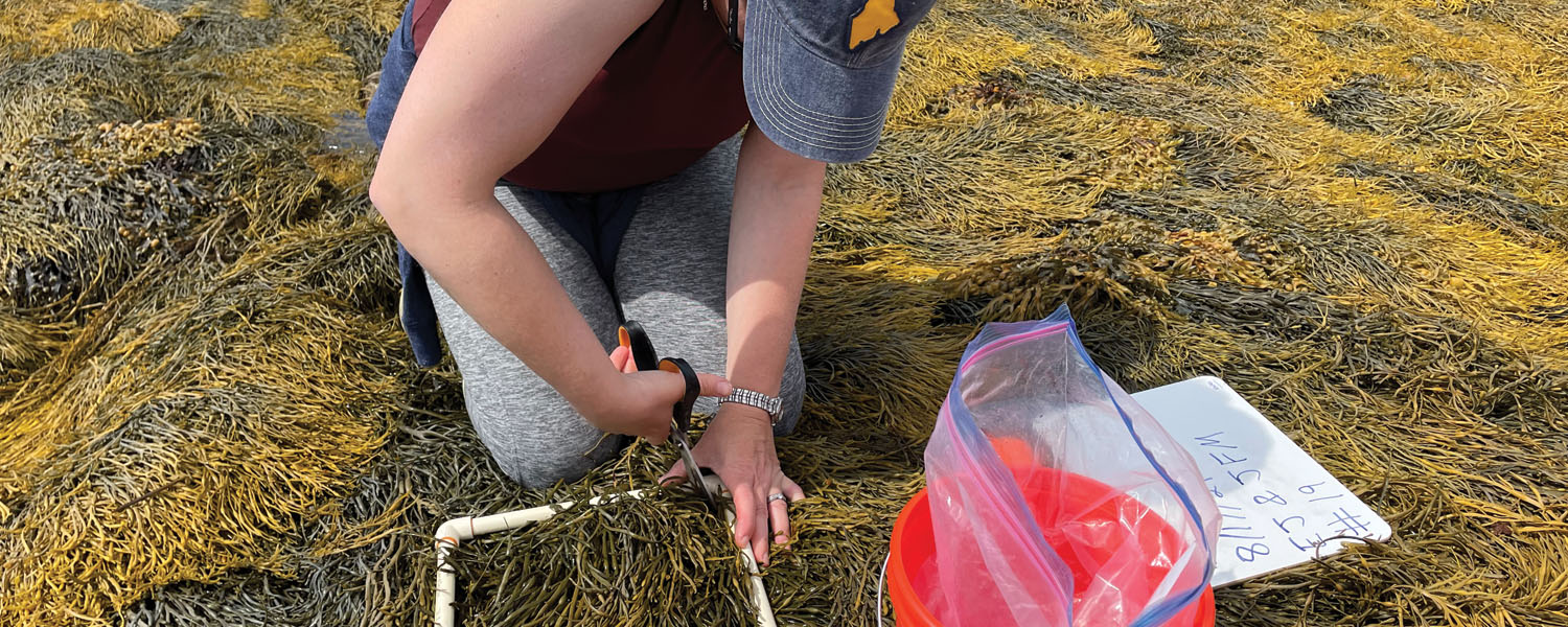
In addition to hand measurements and aerial photos, the researchers take physical samples from each field site. Muhlin explains, “We chunk out the ten-by-ten centimeter quadrant and literally cut samples out with scissors so we can weigh it and parse out how much of it was rockweed or how much it was bladderwrack so we’d have a biomass associated with each sample area.”

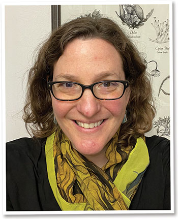
Dr. Jessica Muhlin, Professor of Marine Biology and Chair of the Corning School of Ocean Studies, Maine Maritime Academy.
In the future, Muhlin and her colleagues hope that citizen scientists might be able to complete much of this groundwork, supporting the build-out of an open access library of drone images and field samples that are gathered through grassroot efforts and community building. Already, Muhlin notes, creative collaboration has been at the root of this project’s success. “What I really love is that we’re in this process of discovery and learning together. No one is bigger than the sum of our parts.”
Initial funding for this project came from the Maine Economic Improvement Fund – Small Campus Initiative,* with matching funds from the Bigelow Center for Seafood Solutions and Maine Community Foundation, but the work has only just begun. “My motivation is to help sound resource management,” Muhlin says. “But there are practical business applications and a lot of possibilities.”
In the meantime, Muhlin is focused on what aspects of this project she can bring into the classroom. “We have had two ocean studies interns join us on field campaigns,” she notes, smiling. “But I think the practical application of it is really the ability to conduct authentic research and then to tell students about it in a way that’s accessible and that they can connect to.”
“I don’t think it’s widely known that MMA has scientists conducting original research. When we meet landowners in the field or collaborate with other organizations, I am proud to show how our expertise and scholarship contributes to Maine’s future.”█
*The same funding source that supported the high-tech lab equipment profiled in previous Mariner issue (Issue 2, 2022).
Emily Baer lives with her family in Bucksport, Maine. She is proud to help share Maine Maritime Academy’s incredible stories and to support its faculty and students.


Post Comment
Comments are moderated and will be reviewed prior to posting online. Please be aware that when you submit a comment, you agree to the following rules:
Maine Maritime Academy reserves the right to delete any comment that does not comply with these guidelines and is not responsible or liable in any way for comments posted by its users. If you have a message for the editor, please email mariner@mma.edu.
Features
View All >Read More
Read More
Castine, Maine 04420All Rights Reserved © 2026
Privacy Policy & Terms
Web issue? Contact Webmaster